The Ocean’s Dire Straits: Transport and Maritime Hazards
Where Global Trade Hangs by Narrow Threads
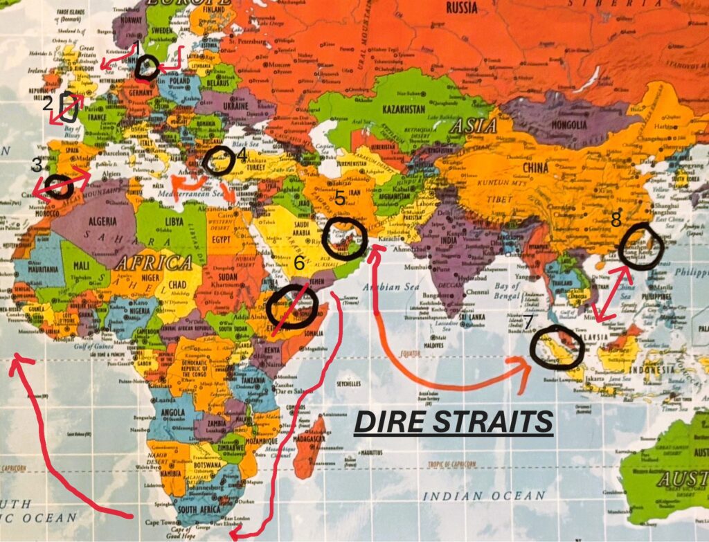
Every day, vessels loaded with copper, crude oil, liquefied gas, and semiconductors thread through the world’s most strategic maritime chokepoints. These oceanic straits—natural or engineered—may span mere kilometers, yet they carry the weight of trillions in trade and the risk of instant disruption.
From the frozen corridors of the Bering Strait to the combustible lanes off Taiwan, from the engineered arteries of Panama and Suez to the critical thresholds of Hormuz, Malacca, and Bab-el-Mandeb—each passage exposes the fragility behind modern commerce.
This is a series about flow and friction, metal and motion, fuel and fault lines.
These are The Ocean’s Dire Straits.